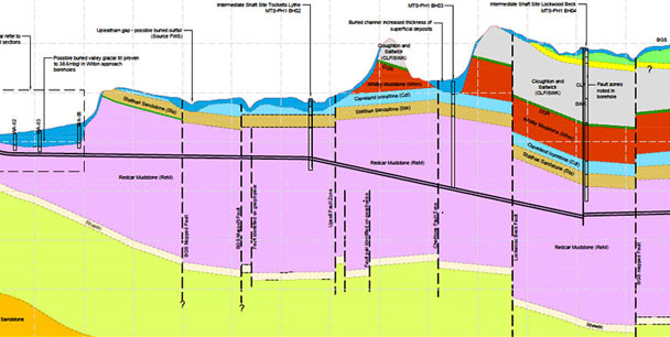
Geokonsult offer services from methodological solutions to applications for various projects ranging from surface and sub surface mapping to large scale remedial investigations and feasibility studies by employing Remote Sensing, Geological, Geophysical, Geotechnical techniques.
With educational backgrounds in engineering, geology and environmental studies, our team is fully prepared to identify and creatively resolve a wide array of geotechnical issues coming across multiple industries.
Our Services include-
- Needs Assessment & Planning
- Infrastructure Mapping
- Transportation Planning
- Highway Infrastructure
- Traffic Management
- Land Acquisition Studies
- Quality Assessments
- Land Mapping & Entitlement services
-
- Landscape Architecture
- Land development & Analysis
- Urban design
- Construction Management
- Assets Mapping
- Canal Infrastructure design & Mapping
- Pipeline Network Planning & Mapping
- Facilities Management
-
- GIS
- Mining Plans
- Geology/Geophysical Surveys
- Reserves Estimation
- Core drilling
- Subsurface Mapping
- Feasibility Analysis

